Monday, November 12, 2012

The Ouachita Mountains of Arkansas


Before the days of the Internet and phones, a very beautiful thing happened in our country: people actually talked to each other. But they didn't just talk about politics or weather. They talked about the land and they talked about things necessary to exist like where the nearest spring was, or salt. I have a cockamamie theory about all this talking, but I think it might be true. The Internet, as a whole, is used to promote things be it ideas or products. I still believe that the most special things - those free of promotion and commercialism - might be the hardest to find. And thus you only know about them if someone tells you about them. They won't be listed on some chamber of commerce website or tourist promotional. I spent one of the best days of my life at a secluded cenote deep in the jungles of a the Yucatan peninsula in Mexico because of this exact idea. A local person, Cynthia Castle,  told us about this secret spot, mostly void of the taint of tourism and we stayed there the whole day swimming, getting a tan, and relishing in the sanctity of that magical place. One of these days I will post a blog about that whole experience. In the meantime here is a video teaser.


I do my best to learn life's lessons as they present themselves, and my Day at the Cenote was a great lesson to learn. That lesson, as I said earlier, is that usually the best places are the ones someone tells you about. They are not advertised. I believe if a place is cool enough that it compels them to mention it, then it's probably worth checking out. 

Now, I do recognize the irony of this blog post. I'm using the internet to tell you that the best places are mentioned through stories told in personal interaction. I hope you will forgive me! However, I consider blog a more modern version of storytelling. Were I to cross paths with you on the street or at a party, I would tell you the same thing I am writing here. Blogs, after all, are just modern versions of a printed letter. 

Now for just a moment imagine we cross paths. We are both on horseback and I am headed west. You are headed east. Knowing you are headed where I just came from I would say, "Friend, let me tell you about a place you simply must go. I want to tell you all about it." Then I would proceed to tell you the following story: 

That place is the Ouachita (Pronounced "Wash-eh-tah") Mountains of west central Arkansas. Nestled away like a naturalist's enclave, these mountains are so remote and rugged they couldn't be developed even if someone wanted to. There are no paved roads and no outside communication. We barely even received a radio station! Amazingly, were you to drive pass the southern edge of the Ouachita Mountains on Interstate 30, you would never even know they were there. But once you head north from Hope, Arkansas, it isn't long before you see them in the distance. 

Donna and I discovered the Ouachita Mountains when one of her friends (ta-da!) told her about them. About four years ago I took Donna on her first camping trip there and we vowed to return, which we did just a few weeks ago. I am always pleasantly shocked by the beauty of these rugged mountains. They are about a three and half hour drive north of Shreveport, but amazingly most people in Shreveport that I have talked to have never heard of them! 

Our original plan was to camp near Little Missouri Falls. Unfortunately, a momma dog with her four pups discovered us when we were about to set up camp and so we felt the need to relocate to avoid any conflict. We searched in vain for a Forest Service worker to tell about the abandoned dogs but couldn't find any. We ended up leaving them some dog food hoping someone of authority would find them, and then proceeded onward looking for an alternate camping site before we lost daylight. 

Although we were sad about the abandoned dogs, our change of plans actually led to an amazing discovery: Bard Springs. 

Bard Springs is a mineral spring deep in the mountains. It was originally homesteaded by Mr. Bard, and the springs were famous for their cool, supposedly healing mineral waters. They even built a bathhouse there in the 1950's. Once the land became part of the National Forest Service, the springs were converted to a campsite. We were excited to find lean-to's, which meant we wouldn't have to fiddle with our tent. 

As always, this trip was too short. We passed three days hiking, enjoying the scenery and relishing in the disconnect from society. Cell phones have zero chance of working up in the Ouachita Mountains. It's refreshing, but potentially dangerous. A few years ago, a flash flood killed 12 people at the Albert Pike campground in this same area. Many of them were in RV's and did not know there was a flood until they were floating away. The lack of phones and radio communication prevented early warnings as well as hampering recovery efforts. Today, Albert Pike is closed except for day use and everywhere you go are a bevy of "Flash flood Area" warning signs. 

Here is a link to that story: 

http://abcnews.go.com/WN/Media/campers-killed-arkansas-flash-flood-albert-pike-campground/story?id=10889327#.UKE4Es1wcwQ

I've said it before and I'll say it again: in our modern society, people forget that most of the advancements we have made are because we have figured out genius ways to insulate ourselves from the reality of nature - and when that falseness collides with reality - sometimes the result are tragic. It only reiterates the importance of knowing your surroundings, watching the weather, and having a plan and a backup plan for all situations. 

One of the major highlights of the trip was the incredible fall foliage. Who needs New England when you have the Ouachita Mountains? We were constantly awed by the colors around every corner and if you love fall colors these mountains should be your next stop. 

Aside from one flat tire on an excursion over to Shady Lake, the Ouachita Mountains were once again a great trip. The weather was nice, and because most of the area is hight then 2,000 feet in altitude, it tends to be six to nine degrees cooler than Shreveport. You throw in a cool breeze and it's perfect camping weather!

As always I've talked too much, so I will let the pictures do the rest of the talking! 

On our way to Arkansas! This dog loves to camp!

Looking West across Bard Springs campsite

Our home away from home


The lean-to had a nice porch which was perfect for Hart

Our cots! 

Who knew a lean-to could be romantic?

Little Missouri Falls

Say cheese!

Looking north up a beautiful valley

Hart couldn't see so he put his paws up to get a better view


Fall foliage

The adventurers

Embarking on a journey


Camping wears Hart out

Nap time? 
Doing my best impression of Hiking Trail Man

Bard Springs


I think this picture would look good in sepia. 


Donna made the waterfall bigger! 

The old Bard Springs bath house is in the background


This reminded me of that scene in
Crocodile Dundee where he says, "Mineral Springs - means no crocs." 

Bard Springs dam

She got all three of us in one shot! 

On Tall Peak Trail


Stopping to rest


In the spirit of the election season, I stopped
 to give a stump speech - literally. 

Shady Lake
The boys being lazy by Shady Lake
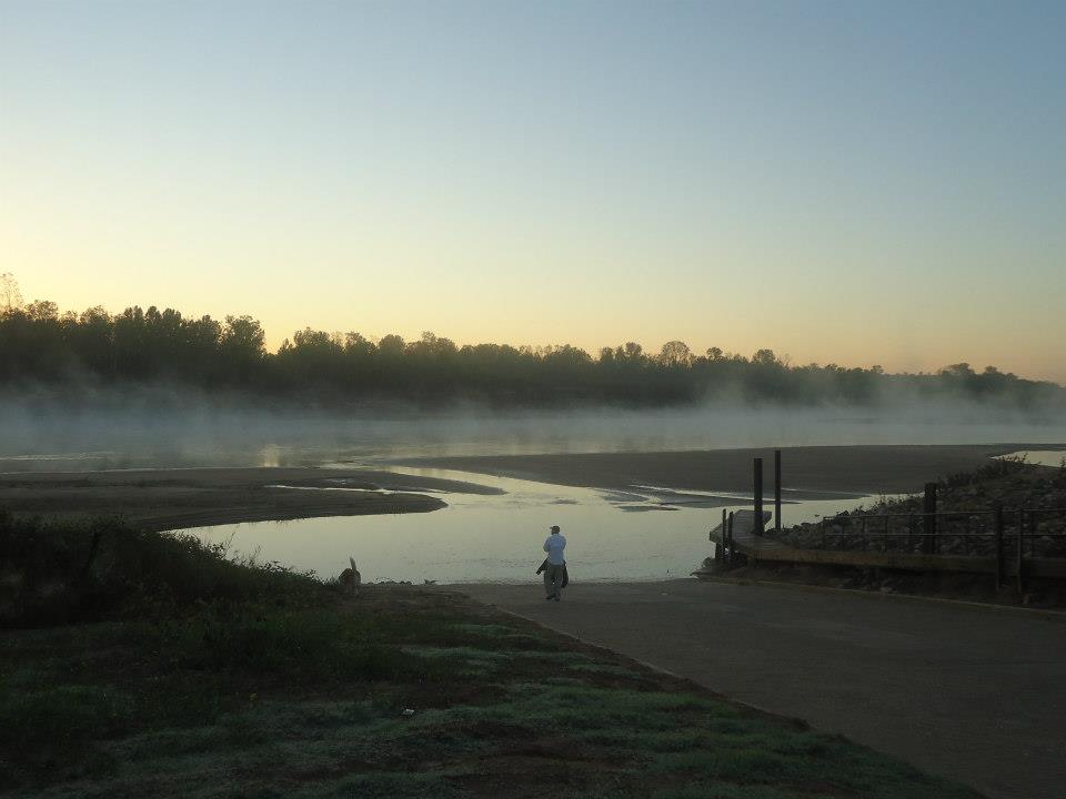

Pondering it all


Until the next adventure!!


Thursday, November 8, 2012

A Visit to the Atchafalaya River Basin!

Adventures can come at any moment. A few weeks ago on a Friday evening I was about to cook myself some dinner when the phone rang. It was Donna's brother-in-law Jonathan, inviting me to spend the weekend at his hunting camp in South Louisiana. I jumped at the chance, and within an hour Hart and I were ready to roll. I keep a lot of camping supplies permanently stored in my car for situations just like this!

The destination for my adventure was an off-the-grid (to remain unnamed) hunting camp deep in the Atchafalaya River Basin. (When I first showed up in these parts I mistakenly thought it was pronounced ATCH-afalaya. I was quickly corrected that the pronunciation is At-CHAF-alaya. My confusion I guess is because we pronounce the Mississippi River MISS-issippi and not MissISSippi.) The funny name "Atchafalaya" comes from two Choctaw Indian words: "hatcha" meaning "river" and "falaya" meaning "long." I like to joke that "Atchafalaya catfish" sounds a lot like "watch you filet a catfish!"


The Atchafalya River is a unique river for several reasons. First of all, it is what's called a "distributary" river, in that instead of originating from a source and then joining a major river, it actually peels off of the Mississippi River and flows toward the ocean. (It also receives the waters from the Red River near the Old River Control Structure.) The Atchafalya River is one of only a handful of distributaries in all of North America. Another unique characteristic is that because of it's distributary nature, the Atchafalaya River is controlled by a dam at the point where it separates from the Mississippi, at a place called The Old River Control Structure. The reason for this dam absolutely fascinates me. Over the decades and centuries, more water had started to flow through the Atchafalaya River than through the Mississippi River, threatening to turn the Atchafalaya into the actual course of the Mississippi River. Why is this a problem? If this happened, it would strand both the ports of Baton Rouge and New Orleans and in the process decimate the Louisiana economy. By the 1960's, everyone realized something had to be done and the result was the The Old River Control Structure, which regulates the flow of both rivers by diverting 30% of the Mississippi River water flow into the Atchafalaya River.  Here is a pic of the control structure.


What does this have to do with the hunting camp trip? The entire Atchafalaya River basin is basically a spillway because in the circumstance of major flooding on the Mississippi River, the Old River Control Structure can be opened entirely, flooding the valley to the south and alleviating the water levels in the Mississippi. Jonathan's camp lies right smack dab in the middle of that flood zone. The result is that per the US Army Corps of Engineers, no permanent structures can be built in that area (except for grandfathered structures). The result is PRIME hunting country.

I arrived late Friday night and spent two nights. I enjoyed getting to know all the guys who hunt there and hearing their stories. I think its always important to remember -as a person who loves nature - that the people are a result of the land - and all customs and culture inherent to a group of people are born from a way of life which came from - you guessed it - the land. South Louisiana, if you have never been, is colorful. The way people talk is inherently entertaining. Combine that with fishing, hunting, and all the various traditions and you get a wildly fascinating culture. This was highlighted the second night I was there when a cajun named Kearney LeFleur cooked up a pot of something called "Catfish Coubion" (pronounced "koo-bee-AH") in a pot that he made with is own two hands. Coubion is basically stew and simmers and warms until it's ready. The best part was the catfish in the catfish coubion came from the Kearney's other camp - a fishing camp. It is a sight to behold, if you ever get the chance: A group of cajun's sitting under the stars deep in the Atchafalaya Basin gathered around a fire, swapping stories, swatting mosquitoes, and chowing down on a pot of catfish coubion.

My stay at the camp was short - too short - but I did get a chance to explore a little bit. I took Hart and we meandered through the woods and explored Bayou Cortableau which bisects the camp. Sadly, I still have yet to see an alligator in the wild in Lousiana, which frustrates me immensely. Although, Jonathan assured me there were some in Bayou Cortableau. The temperatures were warm during the day and the mosquitoes were vicious. But it's Louisiana. And in Louisiana, mosquitoes are part of the deal.

Sunday morning, I rolled back to Shreveport. I fully intend to return to the camp as I have already been invited back by Jonathan. As a momento of my visit, Kearney gave me some red squirrel tails. I have one on my hat (which you can see on the title page of my blog) and one hanging from my rearview mirror in my car. The tails are a fun reminder of my Atchafalaya adventure!

Hart guarding the camp

This cabin is called The "Hilton"


Hart still guarding the camp

He finally gave up on guarding the camp

An unnamed native, who informed me that he couldn't
face the camera because it would steal his soul


Until the next adventure...

Tuesday, October 30, 2012

A Canoe Adventure Down the Red River


I've had a long-standing fascination with rivers. Before there were planes, trains, and automobiles, rivers were the highways. Rivers were everything from water sources to geo-political boundaries, travel thoroughfares to critical commerce lines. Since time began really, as far back in human history as we can study, rivers like the Tigris and Euphrates were basically the most critical component of human development and progress. But we live in a different world now, where rivers – although still important – have taken a backseat to other modes of transportation and commerce. What remains are the ghosts of a fascinating era. The Red River that slices through the Ark-La-Tex is no exception.

For a long stretch of it’s history, the Red River was held hostage by something called The Great Raft, a monstrous river obstruction of driftwood that blocked the river 165 miles in varying sizes and depths. Its removal has to be one of the most unheralded demolition projects in American history. You can read about it at this link: http://www.caddohistory.com/great_raft.html. The Great Raft had been in place for so long, the native Caddo Indians simply said that it had always been there, through thousands of years of oral Caddo history! It’s ultimate removal took the better part of the 19th Century, but it was spear-headed and made possible by Captain Henry Shreve, which of course where Shreveport gets its name. The affect of The Great Raft was so widespread I can’t write it all, but it’s vast and lengthy – everything from the birth of bayou boomtowns like Jefferson, Texas, to a multi-million dollar cotton trade – all were affected by The Great Raft.

That brings me to the whole point of this post: my canoe trip down the Red River in my refurbished canoe, the Donna Lynne. For a long time, I’ve wanted to spend a long day on the Red River. (I'd done a short trip before in an inflatable boat with my friend Matt Keim.) I guess in part this trip was fueled by my desire to take a epic river journey one day which of course was inspired by Lewis & Clark.  I decided to set sail south from a Red River crossing in Hosston, Louisiana, (about 10 miles from the Arkansas border) and head south toward Shreveport. I guesstimated that with a little luck and a tail wind that I could at least make it near Shreveport before the sun went down. Early in October, the perfect weather forecast came along and I couldn’t help myself. I enlisted Donna’s help, who despite having to arise at 6 a.m. got me and her namesake, the Donna Lynne, delivered to the boat ramp in Hosston. Donna snapped this pictures before I took off down the river. I decided not to take my dog Hart. Even though he loves canoeing, I was afraid his endless exuberance at every passing furry creature and his added weight would slow me down entirely too much for this trip. You can see in the photos he was not happy about being left behind. He even chased me down the river a short ways before Donna called him back. The morning broke bright and clear and I set off into the morning light. It was sublime watching the river awake as I embarked on my short journey. 


Although the beginning of the trip was beautiful, it quickly turned from an adventure into a painful, laborious, arm-wrenching struggle. This happened for two reasons. First, the weather forecast called for a slight breeze from the north. Instead, what I got was a stiff breeze which always came from whichever direction I happened to be paddling. The only thing I can attribute this meteorological oddity to is that the river channel itself serves likes a wind tunnel, funneling whatever wind there is up or down the river. (In this case up.) My heavy canoe quickly turned into a sail spinning me around and blowing me upstream. I spent half the trip sitting in the front of the boat and paddling backward. The other factor that contributed to this unfortunate event was extremely low river levels. What this meant is that I only occasionally managed to maneuver into a flowing stream of water. The rest of the approximately 35 mile trip was spent paddling across essentially a lake on a windy day.

That of course is not to say I did not encounter some wildlife. At one point I passed within about ten feet of a big chubby beaver sitting on the bank. He gave me curious stare as I paddled by. I saw numerous birds and fish, as well as the occasional turtle. The Red River above Shreveport is sparsely populated.  Almost the entirely of the day I did not see any human beings. Of course the low water levels kept powered boats off the water so the entire day I had the river to myself.

In retrospect, I would make this trip next time in a one-man kayak.  The problem I kept running into from a navigational standpoint was that I was relegated to simply guessing where the deepest channel was. Needless to say, more than once I got it wrong and ended up grounding the heavy canoe, then had to backtrack upstream and try again. This ate up precious daylight - which ended up costing me later, not to mention the extreme physical toll on my arms. 

By 2 p.m. I stopped for lunch on a beach. 


The Donna Lynne, docked for lunch

It was apparent by this point that my mission was in jeopardy. The slow current and headwinds were simply too much to overcome. Even by this point of the day, my arms were burning with soreness from the paddling. The next five hours would simply be five of the most miserable hours I’ve ever spent in a canoe. Mindless, painful, paddling that droned on and on. At one point I even stood up in the canoe, not wanting to concede the time it would take to stop and stretch my back. In the most awkward moment of the trip, which would have made me look like a crazy person to any one passing by, I laid a paddle across the canoe, leaned back against it and and splayed my legs out forward across the bow. At that point I was doing anything I could to relieve the back pain and cramped legs. Somewhere along the way I snapped this self portrait. 


I could have exited the river at Cash Point Landing, but mistakenly (and hard-headedly) believed I could push on to my final destination near Samstown Casino in downtown Shreveport before dark. About two miles past Cash Point it became obvious I had made the wrong decision and called Donna and asked her to meet me upriver from the casino, officially conceding defeat. I had been on the water for twelve hours and had been out of the canoe a grand total of about twenty minutes. Donna met me (with Hart) in a gated community where we drug the canoe up a steep slope and using every last ounce of engery I had, we managed to get the canoe on top of my car. I was literally unable to lift my arms above shoulder level once my muscles tightened up. Donna snapped this nice pic of me after she saved me from the river.


 Like Apollo 13, my journey down the Red River was a successful failure. It was successful in the sense that I quit talking about doing it and actually did it.  It went from something I was going to do to something I did, which is a surprisingly empowering idea that many people do not fully understand nor appreciate. And it was successful because I gained a basic knowledge of that stretch of the river. It was a failure in the sense that I did not make it all the way back to Shreveport. (Instead of the 42 or so miles, I only made it about 35.) But the urge to explore and persevere never really fades away, so I’m pretty sure I will accomplish this goal one day. All I have to do is wait for a favorable wind, a strong current, and get my hands on a kayak…

Until the next adventure!